|
Troop 24 - The High Adventure Troop
Bridger or Bust
|
|
|
Troop 24 - The High Adventure Troop
Bridger or Bust
|
If the rainbow was a harbinger of good weather to come, the weather on the morning of the sixth day lived up to it with clear skies and sunny conditions. The boys put their rain flies out in the sun to dry as we made and ate breakfast. We all felt pretty good and we got an earlier than usual start on the trail.

|
The trail out of Lost Lake begins to climb immediately. It was cold in the woods as the morning sun was still behind the slope. Pretty soon we were out of the trees and into more open country. Coming over a little divide, the trail goes past a couple of small ponds and continues to wind its way up the hill.
|
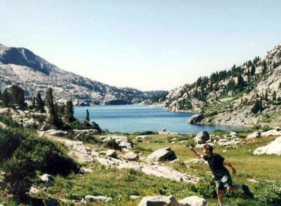
The trail soon skirts another small pond which is shown in the photo above. Just above the pond, we pass the camp of the first group of the hapless hikers. It looks as if they are just getting out of the sack. Still climbing, the trail soon reaches the crest of the ridge and begins its descent to the junction with the trail from Elkhart Park to Senaca Lake. As Kyle, Andrew and I go down the draw we see the rest of the group wating at the trail junction. We have come about 2 miles from Lost Lake and climbed a little over 800 feet.
|
Senaca Lake is a big lake. I had camped just below the trail junction here after a long, long hike from Elkhart Park in 1983. We were just passing through today however. As we are taking our break, a couple and their son come through. Coincidentally, they are from Monroe, Washington, which is just a few miles away from where we all live. It's a small world.
|
From our vantage point, we can see Lester Pass looming above us. Since we have a long climb to the top, we hit the trail again. Just as we come to Little Senaca Lake, we meet a solitary packer and his string heading out. He has been supplying a climbing party in Titcomb Basin. Both his horses look bored and do not register our prescence - unlike the horse and mule strings in the Pasayten who invariably react like we were little green men from Mars.
|
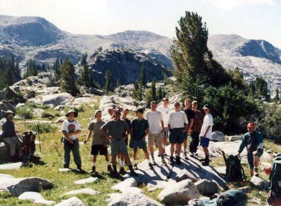
The trail winds it way around the lake and after a couple of switchbacks at the eastern end of the lake goes over a rise and down to a trail junction with the HighLine Trail which we left at Pass Lake three days before. We take a short break at the junction which is about a half a mile from the Lost Lake trail junction. We head out down the Highline trail leaving the Elkhart Park to Titcomb Basin Freeway. There are hundreds of cars in the lot at the Elkhart trailhead and most of them are heading to Titcomb. We saw a large group go by as we took a break at the junction - just about as many people in 1/2 a mile of trail as we had seen on the entire trip to that time. The trail goes right by the end of a long narrow lake just a few hundred feet from the trail junction and begins to climb the hill beyond. After climbing a couple of hundred feet, the trail goes through a basin between two lakes. Beyond the lakes, the trail keeps going up the gentle incline to the end of the basin. Just before the real climb begins, we take a short break. After we resume, I can see the B.S.'rs bunched up as usual way ahead going up at breakneck speed. Behind them the Peter Pacers are making more moderate progress. Back with the F.O.M.'s, it is tough going and even tougher for the oldest F.O.M. of all. Combining the altitude with the steepness of the trail, makes this stretch an old man killer. I fall behind the others as they make their way a couple of switchbacks ahead.
|
|
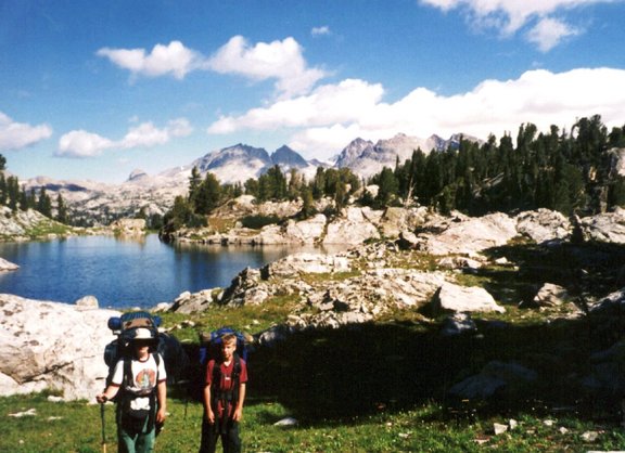
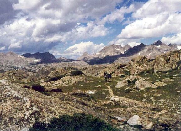
The benefit to the steepness is that the pass is soon reached, and as the trail levels out somewhat the broad back of 11120' high Lester Pass is reached (about a mile and a half and a 750' climb from the junction with the Elkhart Park trail).
Brian took the picture above of Andrew and I coming up to the top. The view looking north shows Elbow Ridge far in the distance to the left (west) and Bow and Arrow Mountain directly to the north.
|
Looking south from Lester Pass, the mountains seem a little tamer than those to the north. Dominating the view are Anger Peak and Angel Pass to the southeast and Baldy Mountain to the southwest. We can see Nelson Lake below us to the west. It is off the trail but we had tried the fishing there without luck in 1983 for golden trout that are reputed to inhabit the lake.

|
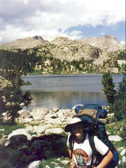
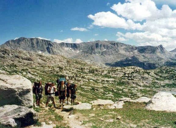
After a break for lunch at the pass, we were off down the trail again going through an open basin with few memorable landmarks. The trail passes above Tommy Lake and I took the picture above. The lake is well below the trail and as we had no luck there in 1983, I had no overwhelming desire to try again.
|
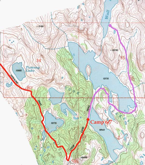
The Tommy Lake viewpoint is a little more than a mile from Lester pass and the trail continues it's way down through open country. Soon after the trail enters open forest, it descends more steeply and comes out above the first of the Cook Lakes, lake 10175'.
Along Highline Trail (Elev. 10175') |
The trail skirts the western shore of the lake. Climbing down a granite outcropping, the trail crosses a stream between the main lake and a small pond below. We had camped here in 1983 on the last night of our trip and I remember flyfishing for small brook trout in the small pond. Although the fish weren't big, we did catch quite a few of them. This is a beautiful lake, being rimmed with forest and set in a bowl with high peaks beyond. We meet a couple on a day hike up the trail and assume that they are camped at the lake. They appear relieved that we camping further on down the trail. The trail goes up a small hill at the end of the lake. The other F.O.M's disappear over the top as I take the picture of Andrew above. By the time we get to the top, the rest of the group is long gone. When we finally catch up they are taking a break at a trail junction. The Highline Trail keeps going south while the trail to the west goes to the Cook Lakes and the trail to the east goes down to Pole Creek Lake. The junction is about 2.5 miles from Lester Pass. We head up the trail as it climbs up alongside a small stream. After passing through an open meadow, the trail enters the woods again and goes up over a high point and drops through woods and comes out in meadows above Lower Cook Lake (10143'). There is a small camp high above the lake it's unanimous that we will stop here fore the night. |

|
Even though we have had a long day, we get into camp early enough to do a little fishing and exploring. Bill and Brian head up the trail to explore the upper lake. Most of the rest of us unlimber our rods and try our luck in the lower lake.
The view from our campsite is outstanding as can be seen in the above photo. The fishing is fair compared to the Bridger Lakes. Like the Bridger Lakes, the Cook Lakes are inhabited by 8 - 10 inch Brook trout.
We are entertained by a pair of ospreys as they hover and dive into the lake for trout. They really make a splash when they go in. Because our gas is running low and we have time to make a good fire, we cook over the fire using our aluminum plate to stabilize our pots. The heat warps the plate badly but we keep it level enough to finish the dinner.
The site has limited tent sites so we have another "tent city" with the tents bunched together on either side of the trail. As the sun sets, the mountains turn pink as the sun sets and our sixth day on the trail comes to an end - the first day that we have not had any rain. Maybe the rainbow at Lost Lake was a good omen after all.