|
Troop 24 - The High Adventure Troop
Hidden Lakes - Pasayten Wilderness
|
|
|
Troop 24 - The High Adventure Troop
Hidden Lakes - Pasayten Wilderness
|
In June, a backpacker has his eyes to the high country. In the lowlands of Puget Sound, summer is in full swing but the mountains are still wrapped in a thick blanket of snow. Itching to get out, we decided to try a trip to the eastern side of the Pasayten Wilderness, where a light snowpack meant an earlier than usual opening.
A trip to the Hidden Lakes looked promising, although most of the passes were near or above 7000', most of the trail was on south facing slopes or at lower elevations. It was not promising when we found the road blocked by several feet of snow and large trees leftover from a winter avalanche about a mile and a half from the trailhead.
Well, Troop 24 is the High Adventure Troop, so the prospect of a little snow didn't deter us from setting out as scheduled. The skies were darkening as we drove up the road, and when we unpacked our gear a full blown downpour opened up. After waiting out the brunt of the storm under the eaves of a convenient outhouse, we took off as the rain abated.
Due to the long drive and our late start caused by the rain, it wasn't till about five o'clock that we had climbed the 1300 feet to our first pass, 5500' Eight Mile Pass which was snowfree.
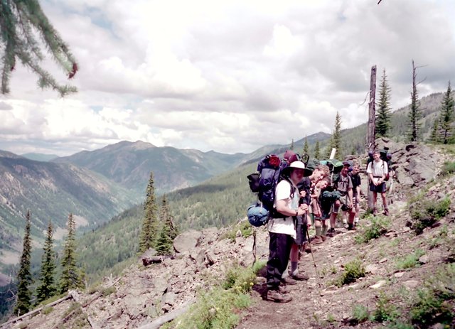
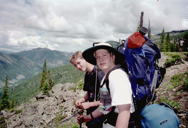
View up the Lost River Near Lucky Pass |
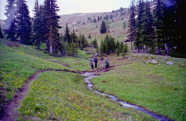
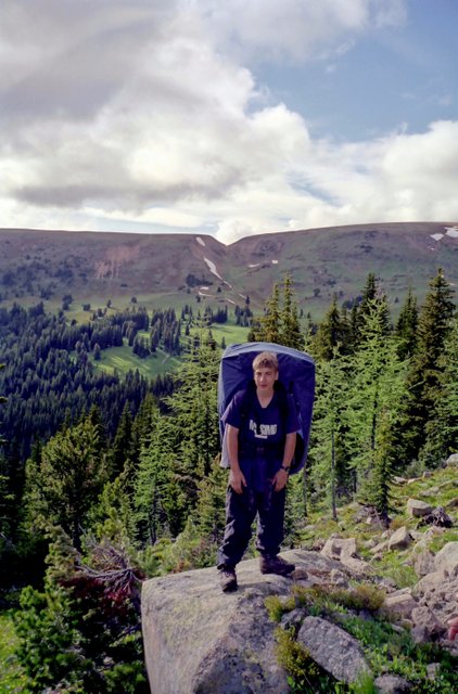
Skies were clearing as we started down the trail on the back side of the pass, and we pulled into our camp at Drake Creek about five and a half miles from our cars. Our Second day began with another 1300' climb up to Lucky Pass. After that it was a long traverse of the ridge on the east slope of the Lost River down to the valley bottom itself. Views along the ridge were grand. We were lucky in that most of the rainshowers that day seemed to pass on either side of us. It was a long day. (In the picture above we hiked to the foot of the mountain in the photo and then another 2 miles up the valley to Cougar Lake.) Along the way, we met a solo woman hiker who told us there was an interesting octagenarian camped out at Lower Hidden Lake. (The boys were a little disappointed when she revealed that she liked to hike topless but that she had had a premonition and put her shirt on just before meeting us.) |
|
Along the way, we had several horse groups pass us on their way out from the lakes. As one particularly long pack string passed us, Danny blurted out that "those horses have awfully long ears". I told him - "Danny, those aren't horses, they're mules".
|
The Pasayten is a big, wild place that seems to swallow you up. The horses you meet treat you as if you came from another planet. Their eyeballs bug out of their sockets and they are very skittish as they pass you. In contrast the horses that we saw in Wyoming, never even broke stride or looked at you when they passed you on the trail.
|
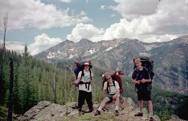
Leaving Cougar Lake |
After the 9.5 miles to Cougar Lake, my feet were worn out and I didn't try my hand at the fishing in the lake but crawled into my sleeping bag and took a nap, something I almost never do. I guess that old age is creeping up on me. Some of the boys had good luck though with rainbow trout about a foot long. When we got up and out of our tents the next morning, there wasn't a cloud in the sky and it looked as if it was going to be a good day. In the Pasayten, however, there is one thing about the weather thats a given - it is bound to change. The usual pattern is that it is nice in the morning, and even on the best days, clouds will develop from late morning until late in the day, when the sun begins peeking through the clouds. As night falls, the clouds disappear and the heavens open up for stargazing. |
Well, it looked so nice but it didn't take long for the skies to darken and just before we took out we had another downpour, which we avoided by seeking refuge under the trees. When the rain let up, we took off in a light drizzle.
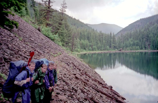
Our destination was the Hidden Lakes and it wasn't long till we had covered the two miles to the First Hidden Lake. There were three old gents camped out at the shelter and you could see from the size of the fish that they had hanging from a stringer that the fishing was good.
I struck up a conversation with them and asked about the "Octagenarian" that was supposed to be camped nearby. One of the campers harrumphed and said that the guy wasn't 80 years old but only 74 and that he was 70 years old himself. He said that his group had been hiking together for years and tried to get into the Hidden Lakes every year. They had even packed in an inflatable raft.
Meanwhile most of the others were out trying their hands at fishing. The occasional whoops heard coming from downlake meant that the fishing must be good, so I excused myself and got my fishing gear and went out to try my luck.
Just before it was time to quit and continue up the trail, I had a good strike and caught about a 15 inch rainbow that put up a good fight. We had a pool on, and I was wondering if it was big enought to keep. Just then Brian came up the lakeshore and brought his fish down. It was about an inch longer than mine so I released the fish back into the lake.
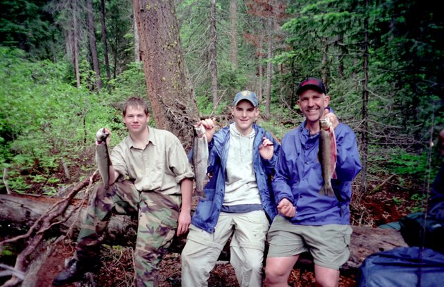
Adam, Brian, & Bill
|
To win our pool, we have a rope and we measure the length and then the girth of the fish to determine the winner. Of the fish in the photo above, Brian Peckingpah's rainbow was the largest and was tied with his dad's (Bill P.) from the previous year (we left the knots in the other end of the rope to record the biggest fish from all trips. Just a little ways from the lake we met the 74 year old "octagenarian" camped under the porch of the forest service guard station. He looked like Teddy Roosevelt with riding pants that were tight at the lower legs but flaring out at the thighs. On top of that he had on a pair of leggings over his shoes and pant legs. He said that he makes all his clothes and equipment during the offseason. He showed us his tent and sleeping bag combination that weighed less than 2.5 pounds - he had taken an ordinary sleeping bag and taken off the top half and then made a tent that would zipper onto the remaining bottom half. |
He also had a 1.5 pound raft made out of the same fabric that the astronaut's space suits were made of. He quipped that there weren't too many people who caught fish that weighed more than their boats. He said that he usually hiked about 500 miles a year and it looked like he had been just about everywhere.
Taking our leave, we hit the trail and made our way past the Middle Hidden Lake and on to the upper end of mile long (and seemingly neverending), Big Hidden Lake where we made camp. We had a big dinner of Mountain Chili and then Brian cooked the trout we had kept.
Some of the guys tried their luck at fishing but they weren't getting any strikes on their lures. Kyle said that he was going to try out some powerbait and he took off down to the lake. It wasn't too much longer until we heard whoops and excited yells, that Kyle had a big one. He soon ran up with another big rainbow. When we put it to the rope, it was found to be the biggest yet.
When Roger heard that Kyle had caught a big one, he got his pole and powerbait and headed out. Kyle was walking around about two feet off the ground and talking like he had ingested helium. "I didn't horse him in, I played him out, etc., etc.... As Kyle went on, we again heard shouts from down at the lake, including "It's bigger than Kyles." Poor Kyle, he went from ecstasy to despair in 15 minutes when Roger's fish was found to be as fortold "even bigger than Kyles".
After this a discussion ensued, as to whether it was really fair to allow a Powerbait fish to win the pool. Roger was rendered almost speechless that we decided to have a vote. It was decided that it was against the rules to allow a Powerbait fish to win the pool, but that since this wasn't clear at the time, Roger would split the pool with Brian who had caught his fish on a spinner.
Hitting the trail in the morning, we hiked down to the East Fork of the Pasayten River. Fortunately, we found a very shaky log over the torrent. It was on of those double log ones that I hate, and it vibrated like hell as you put your wieght on the other foot. I was lucky that I didn't take a plunge.
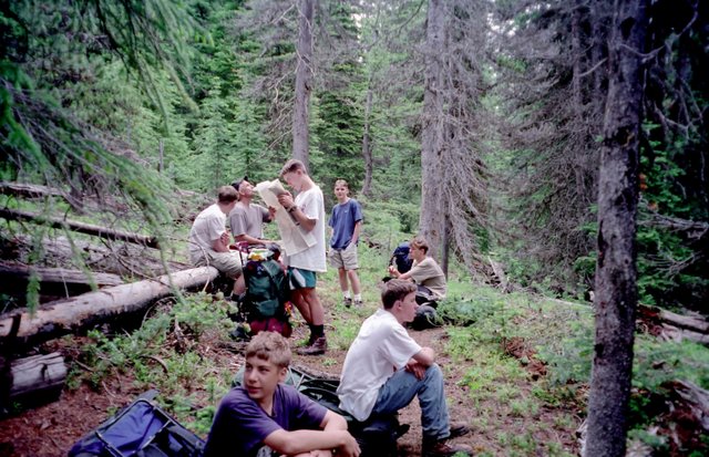
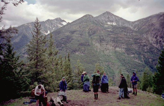
Break Along East Fork Pasayten Trail |
After the stream crossing, we found the junction to the East Fork of the Pasayten Trail just a couple of hundred feet above the stream. From this point it was a valley pounder, although the terrain was pretty open and we had occasional views to the ridges above the valley. It was clear from the condition of the trail that it was little used and that we were the first travellers into the area that year. About six and a half miles from the lakes, we came to the junction of the McCall Gulch Trail which climbs to the Larch Creek Trail near Larch Pass. We had a decision to make - whether to continue on the East Fork Trail and go over Dollar Watch Pass (Where Andrew and I had hiked to from the other side in 1992) or take the slightly longer trip up McCall Gulch.
|
Meadows Along McCall Gulch Trail
|
Looking through the trees at Dollar Watch Pass at the head of the
valley, we could see a lot of snow on the north facing slope. We
decided to go up McCall Gulch as it went up the south facing slope
in the hopes that there would be less snow.
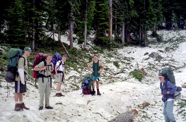
Even though we had been valley pounding up the East Fork, we had already climbed almost 2000 feet from the stream crossing that morning. As soon as we turned onto the McCall Gulch Trail (which doesn't show on the map by the way), we began to climb in earnest, with switchback after switchback. After about a thousand foot climb, the forest gave way to the meadows of upper McCall Gulch. This is a beautiful area, with wide meadowed slopes and bubbling brooks. Because we were above 7000 feet, the temperature dropped to the mid thirties our spirits were high because we had made it back to the high country again. |
Kyle "Harry B." Meissner
|
When we hit the Larch Creek Trail, it was the second time for most of our group as we had come up this trail over Larch Pass two years before in 1996 on our Crazyman Trek. As we headed up the grade to 7150' Larch Pass, we found the first snow patches covering the trail. These were no problem and we soon made it to the pass. As we neared the pass, we could see the long climb that we had made up the East Fork of the Pasayten. We could also the "vee" shaped Whistler's Notch, through which we had gone in 1996 on our way up to the Boundary Trail near the Canadian Border. The pass was frigid as usual. In 1992, Andrew and I had hiked over the pass in a rare early September blizzard. It didn't look like the weather was going to be too bad so we decided to camp at the pass at the campsite we had used in 1996. It was on of the few times, that we had come back to a campsite that we had used before. In 1996 we had hiked from the Fox Lakes to Larch Pass using the abandoned and hard to follow Diamond Jack Sheepdrive. |
Camp at Larch Pass |
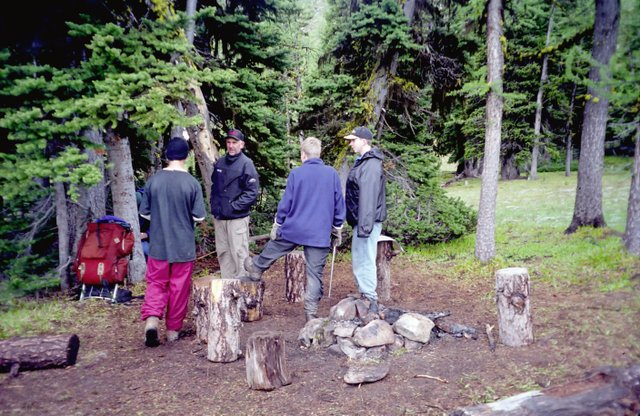
When we had camped there, there was an outfitters wall tent set up about 100 yards from our camp. In the tent there had been a two man saw that the boys used to make a bunch of "camp stools". We had made enough for all twelve of us on that trip. In two years about half of them had survived. I was bushed, as we had climbed a total of about 3200 feet and hiked about 10.5 miles. The boys had a lot of energy left and I turned in early. Most of the time, I hang on to the end but I was exhausted that night. In the middle of the night, we could hear drops hitting the tent. Fortunately, it was rain and not snow. It was still raining when we got up in the morning - not the robust rain of the west side but a cold drizzle that made your want to stay in bed. |
The trail from Larch Pass makes a long descent down to the valley of Larch Creek. After about two miles we came to the switchback and saw the cairns we had built to mark the junction with the Diamond Jack Sheepdrive. Some of the boys, wanted to head up this route back to the Fox Lakes, but I said that we didn't have enough time as we would need another day in any event, and that we didn't know how much snow we would encounter.
So we headed on down the Larch Creek Trail with some regrets that we didn't have more time. About four and a half miles from the pass, the trail comes to the end of the Larch Creek Valley and turns east to the crossing of Diamond Creek which we had crossed downstream on our second day on the way to Cougar Lake.
The trail climbs almost 600 feet to Three Fools Pass passing along the way the junction of the Diamond Pass Trail which we would have come down had we had time to hike to the Fox Lakes. After crossing the broad pass, we dropped about 450 feet and found a nice camp near where the trail crosses Two Bit Creek.
We had a nice camp, with deer very boldly walking through camp to graze anywhere that someone had urinated in order to get the salt that was deposited. We could see snow in the area of Billy Goat Pass but we thought that as we had had no trouble heretofore, we would have easy sailing on the morrow.
Where's the Trail? |
The first obstacle we had was the ford of Drake Creek, our old friend that we had camped beside on our first night. Most of us were able to cross without getting our feet too wet. As we climbed the switchbacks up to the meadows below Billy Goat Pass, we encountered snow patches. As we went along, the snow covered the trail completely. In a ways, we came to an area that had been hit with a large avalanche and our way was blocked by many trees knocked over in the big snow slide. We knew where the pass was so we painstakingly made our way up the snow, being wary of snow bridges over the many streams carrying the snowmelt down to Drake Creek. I had gone through one of these many years before, completely disappearing and landing in a creek. Fortunately, I hadn't broken anything and had only succeeded in scaring the daylights out of the kid that was trudging along behind me. |
Most of the boys were having a ball, but it was a grind for me. As the heaviest, I would break through more easily than anyone, and had a couple of falls. As we passed the avalanche area, we were able to get back to where the trail was and follow the blazes on the trees. It wasn't long before we made the top of 6600' Billy Goat pass.
After a lunch at the top, we made our way down leaving the snow at the pass. It wasn't long till we were back to the trailhead (and its welcome outhouse), and then down the road to the cars. We saw a few people hiking up the road in clean "civilian" clothes. We looked (and smelt) like a bunch of mountain men that had been out for a week, which we had.
It felt good to change to fresh clothes and head out. We stopped in Winthrop, a tourist destination, to find ourselves suddenly thrust back into civilization. We donned our uniforms and went in and had burgers and pizza. After a week of freeze dried food, you can't imagine how good this tastes.
Bill Peckinpah says that this is because we don't get enough fat in our diet and we are slowly starving ourselves. The carbohydrates and starches that make up the diet do not provide enough calories to make up for what we are expending. For the boys who have no fat reserves to draw upon, it really has an effect. It is no wonder that almost all the conversation on the last night is always about what we are going to eat when we get out.
All in all it was a good trip. The weather had not been the best, but it wasn't unbearable either. Even though we had used our raingear a lot, there had been a lot of sunny periods too. The fishing was spectacular, and with the cold weather, the bugs were non existant. In six days we had travelled about 45 miles and had about 9000 feet of elevation gain.