|
|
|
|
|
Day 3: Camp Near Lonesome Lake to
Valentine Lake
via the Lizard Head Trail
|
|
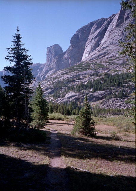
The Dog's Tooth |
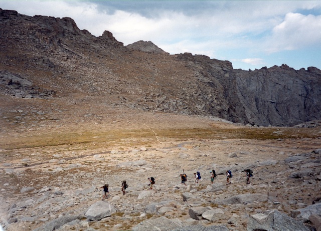
It was a cold morning, but the sun was shining through the trees giving the impression of warmth. We fixed our breakfast, packed up, and headed on down the Popo Aige. The canyon is very "Yosemite" like, open with soaring walls on either side. Looking up valley, the Cirque of the Towers held court like the Knights of the Round Table. Out in the open, it was warm in the sun as we trudged down the valley. After about a mile and a half we passed through the upper part of the Lizard Head Meadows and a short while later arrived at the Lizard Head trail junction (10000’-1.7mi.).
We took a short breather at the junction, before heading up the trail into the forest. The trail steeply switchbacks up the slope and after about a 600 foot climb, a side trail to the Bear Lakes is encountered (10590’- 2.4 mi. From camp), where I find the guys waiting for me.
We head out and after a few switchbacks the forest cover thins out and we have good views of the Bear Lakes below us and the Cirque of the Towers now a considerable distance up the valley.
The way becomes very steep after a major switchback to the south (10800’) and a serious climb ensues made more difficult because of the altitude (11000’+).
At about 11500’ (3.1 mi.), the trail levels off a bit and we take a break and take in the views back to the C.O.T., Lizard Head Peak and the Bear Lakes.
|
|
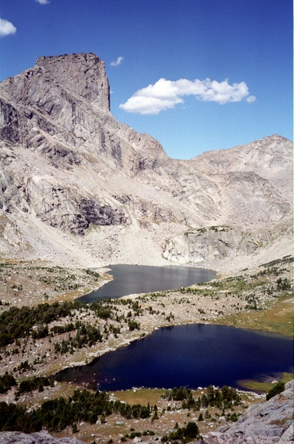
Lizardhead Peak & Bear Lakes |
Traversing opposite Lizard Head Peak, the trail passes what is marked as a "spring" on the map, but there is no more than a trickle, certainly not enough to fill a canteen. Now heading west, the trail goes over a little rise, levels out again with a low ridge ahead marking the top of the climb.
A couple of tarns on the north side of Lizard Head Peak are now visible, with a snow bank at the upper lake. After a last climb, the guys appear clustered around a wooden pole set in the ground marking the top of the pass (11875’- 4.2mi.). The pass is not named on the map, so we will refer to it as Lizard Head Pass.
We take a long lunch break and enjoy the view to the northeast. The view from this side is less spectacular. Although the elevation is comparable to that of Italy Pass in the Sierras (see 1999 trips) the terrain seems less desolate. Maybe it is because there is no threat of a thunderstorm or brooding clouds hanging over us. A little sunshine goes a long way to lifting the spirits.
|
|
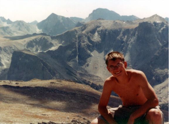
Shelby - High Point (Elev 12539') |
The usual crowd (Austin, Roger, Danny, and Peter) are soon involved in a card game. Jason, Shelby, and Buckwheat espy a high point (12539’) to the south and head off to climb it.
Fred and I head out down the trail, knowing that the young bloods will have not trouble catching up with us. The climb to peak 12539 nets a new troop record for elevation, higher than the 12400’ of Italy Pass in the Sierra Nevada.
|
|
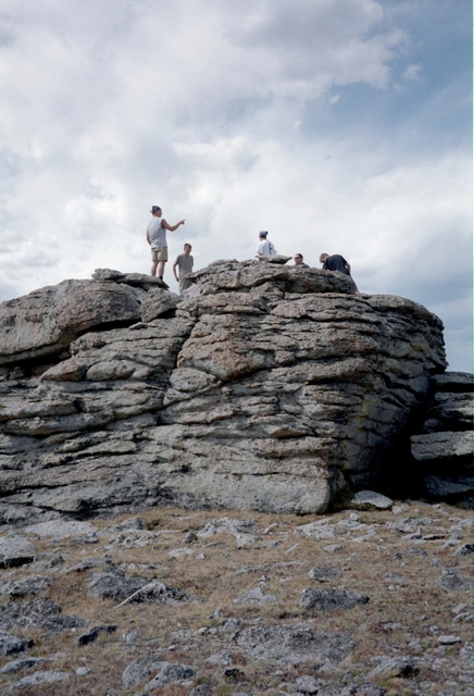
Climbing Big Rock |
The countryside is wide open and the trail winds around the boulders littering the surface. The sparse vegetation has turned into the reds of autumn. Looking back we see the glacier tucked into the north side of Camel’s Hump. We continue a gradual descent as we traverse in a northerly direction.
As we descend into a small drainage (11540’-5.7mi.), we can see the trail climbing up the other side. We make the climb to a small pass on the shoulder of Cathedral Peak (11800’- 6.1 mi.).
Looking back we can see the guys catching up, so Fred and I doff our packs to wait for them. We have a good view to the North and East, a whole lot of rocks as far as the eye can see. There was a house-sized rock just off the trail, and the guys are soon off climbing it.
From the pass, the trail traverses to the northeast. We see a pass in the distance, but we can see the "Bear’s Ears" trail coming down the opposite slope.
After a short series of switchbacks, and a short way across the basin, the Lizard Head trail ends at the junction with the Bear’s Ears trail (11520’ – 7.2 mi.).
|
|
Near Jctn of Bear's Ears Trail |
This trail heads west down the drainage. Moderately descending at first, the first switchbacks appear as the terrain steepens.
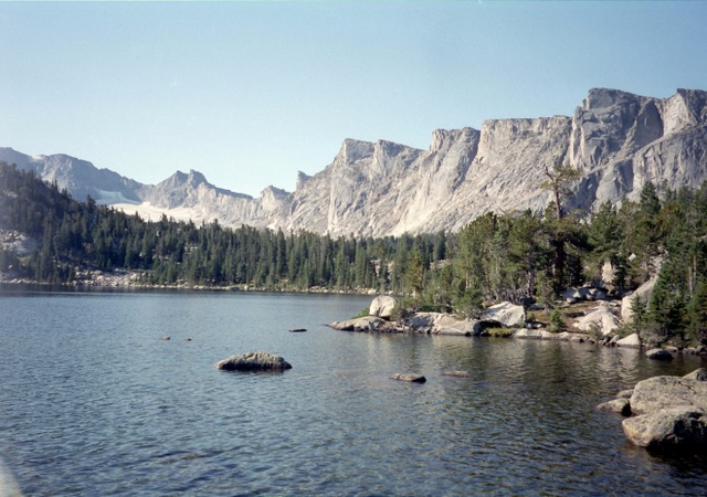
Soon Little Valentine Lake appears below us to the west. One stretch of the trail has been blasted out of the cliff and one would not want to meet a mounted group at that spot. Dropping down into the forest again, the trail comes to the Moss Lake Trail Junction (10520’- 10.4 mi.).
Fred and I are getting tired, but the Moss Lake Trail means that our destination (Valentine Lake) is not far off. Soon the cutoff for Valentine Lake appears, where Danny and Peter are waiting for us. It’s a short stretch down to our well used but adequate camp above the lake (10420’ – 10.8 mi.)
|
|
Valentine Lake |
After resting, Fred and I head out to do some fishing. Danny sees a good-looking chick, so he swims around the lake to introduce himself. The guy with her is pretty protective so Danny doesn’t make much headway.
What he does do, is come up with a case of near hypothermia and is a true shade of Husky purple when he climbs out of the water. A stint in the sleeping bag and he has his color back and is soon engaged in another card game. The fishing is poor. Fred gets skunked, and I catch only a five inch golden trout.