|
|
Chickens to Jackass Pass - Day 1
Troop 24 Kickass Trekkers
|
|
It takes about a day and a half of hard driving to get from the parking lot at the Martha Lake Community Club to the Big Sandy Trailhead, high in the Wind River Mountains of Wyoming. We got off to an early start, and it was still dark when we pulled out of the Martha Lake Community Club Parking lot. Fred was driving "Moby Dick", his old Chevy Suburban, and I my Corolla. I had thought about taking the "Grey Ghost" or "Silver Bullet" (as my 85 Camry is called), but remembering our trials and tribulations of our ’98 trip to Wyoming, I opted for the newer car and its air-conditioned interior. There were nine of us making the trip: Fred, Shelby, Austin, Roger, Danny, Peter, Buckwheat, Jason, and myself. Except for Fred and Shelby, all of us had made the 1998 trip. Our destination the first day was the "Budget Motel" in Burley, Idaho which is about 600 miles from Martha Lake. This is a long, long drive, which we have made many times in the last few years on our hiking trips. Our first stop was the McDonalds in North Bend for breakfast. As we were pulling out I could have sworn that I heard a rooster crowing in Moby Dick, but it was early and I figured that the guys were probably having a little fun. From there the trip followed it’s usual course: stop at a rest area before Yakima, gas up in Pendleton, have a few "yuks" remembering our stop at Farewell Bend in Oregon in 1998, and then the long drive through Idaho. We pulled into Burley in the late afternoon and got our rooms at the "Budget" where we have become "regulars" as this was our third stay in a year and a half. Fred and I had one room to ourselves while the all the rest (7) opted for the other. We were up bright and early the next day and hit the road after breakfast. In a little while, the sun rose making driving hard as we were driving directly east. But the valley gradually curves to the north and we make our way through Idaho Falls and again turn east and soon find ourselves in Wyoming. The route from Idaho Falls is very scenic compared to what we had endured up till then.
|
|
We roll into Pinedale around noon and give everyone an hour for lunch and to explore. After getting the required fishing licenses at the "Great Outdoor Shop", we hit the road again. We gas up in Boulder and begin the rough ride to the Big Sandy trailhead. A few miles out of Boulder we pass a fenced off compound that is identified as "Air Force Earthquake Study Facility". This seems puzzling to me as this area is not known for earthquakes, and why would the Air Force be studying them anyway? Then, putting 2 + 2 together, I remembered our "UFO’s" from the 1998 trip, I wondered if that was what the facility was there for. It made more sense for the Air Force to be studying UFO’s than Earthquakes, and the facility stuck here out in the middle of nowhere seemed a little strange. I wonder??? |
|
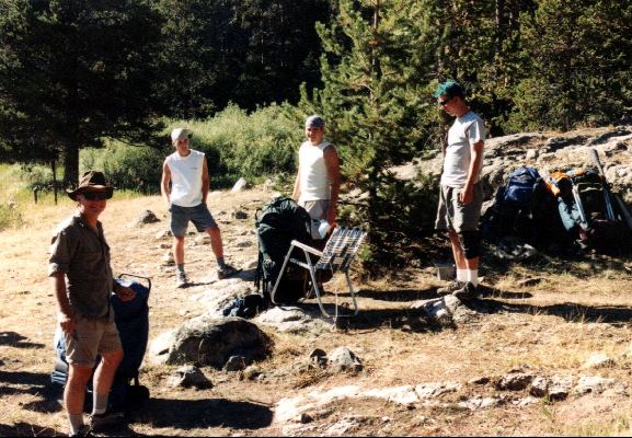
Almost Ready to Head Out |
|
The further out we got, the worse the road became. The last few miles to the trailhead were severely "wash-boarded" and my Corolla was shaking to beat the band. At last we finally made it. The parking lot at the Big Sandy Trailhead (Elev. 9120’) was pretty full but we found spaces near the trail. After we got all the gear unloaded (and it was quite a pile) and distributed, Roger brought out this chicken and set it down beside gear. I told him, "Roger, you’d better take that back. It belongs to someone." Roger gave me a big s... eating grin (as only Roger can do) and replied, "It’s ours, Bill. I can’t take it back. And besides we have three more in the car." I guess the expression on my face, was worth driving a thousand miles with four chickens. It also explained why the guys would complain about the smell in Moby Dick when they came back to my car during the trip. |
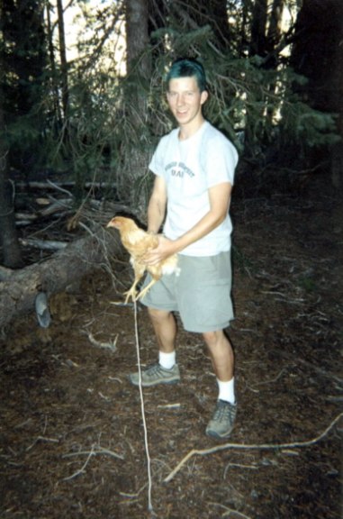
Austin & His Hen |
Day 1: Big Sandy Trailhead to Vee Lake
|
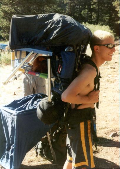
Getting the all the gear for 9 guys and 4 chickens together took a long time and it was very late in the afternoon when we finally shoved off. I had hoped to get fairly far the first day, but as usual things did not go as planned. It was great to be back in the Winds with the blue, blue sky and the granite peaks. We headed up the trail and soon left the main trail to Big Sandy Lake(.6 mi) and turned north onto the Fremont Trail. After climbing a bit we came to Meeks Lake (9305’- 1.2 mile), but there were no campsites available so we took the Vee Lake/ Diamond Lake Trail. |
|
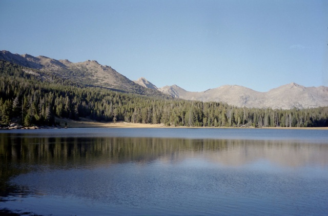
Vee Lake (9420’ – 2.1 mi.) soon came into view and we found a campsite in the woods opposite a big meadow west of the lake. Our campsite was in shadows when we arrived and we wasted no time in getting unpacked and settled in. Due to the late start, we had only made two miles from the trailhead, but we had a good camp on a scenic lake, so what more could you ask for. The chickens were set free to roam and the stoves were soon chugging away heating the water for our supper. After the sun had set and the last remnants of daylight ebbed away as the dishes were done. Soon a card game was in progress and all was well. The chickens knowing it was time to roost, circled the camp and finally homed in on Peter as the roosting spot. We all had a big laugh, but Peter wasn’t too thrilled. Shelby and Roger then took the birds and put them on lawn chairs a little ways away and they settled down for the night. We hadn't gotten far on the trail, but we were on our way and it felt good to be back in the mountains again. |
Vee Lake at Sunset |