|
Troop 24 - The High Adventure Troop
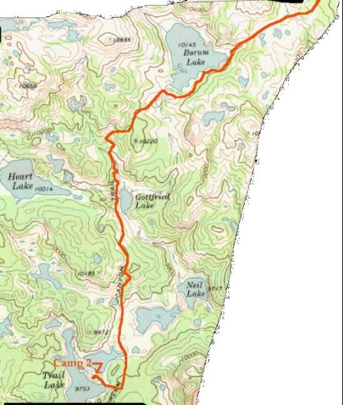
Bridger or Bust
|
|
|
Troop 24 - The High Adventure Troop
Bridger or Bust
|
|
We tried to get an early start on our second morning out, but we were still in shakedown mode so it was about 10:30 before we hit the trail. Although there were clouds in the sky, they only intermittantly covered the sun. After retracing our steps back to the Pine Creek trail, we headed out past a companion lake to Trail Lake and up a small pass (250' climb) and descended to Gottfried Lake (a little more than a mile from Trail Lake). By this time the hiking rythms of the group had established themselves. The lead group was headed by Jason, the hikemaster. The hikemaster is an important position as it is his call as to the pace to be set, when time for a break has come, and to keep the group from getting too strung out. In Jason's group were Brian, Bill P., Jon, Austin, and Roger. Because they hiked so fast, I nicknamed them the Butt Sniffers, or B.S.'rs. The middle group lagged behind the B.S.'rs were headed up by Peter and usually included Danny, Cary and sometimes Roger, Kyle, and Austin. This group was called the "Peter Pacers". Behind them (way behind in my case) were Charlie, Greg, Adam, Bill M., Kyle and Andrew. Because Greg and I tip the scales at over a quarter of a ton between us, this group was called the F.O.M.'s (Fat Old Men). Kyle and Andrew usually kept me company while Adam usually hiked with Greg. Charlie sometimes hiked with us at the end, sometimes with Greg and Adam and sometimes by himself. |
|
Not wanting the group to get too spread out, I would have Jason stop at an identifiable landmark (lake, trail, creek crossing, etc.) or when no such was available set a time for the lead group to stop. This accordian like approach seems to work well when the abilities of the group vary. By the time I caught up with the head of our group, Brian had his fly rod out and was trying a few casts for the trout I could see rising to feed on the Lake. Gottfried Lake is a small lake but we could see it had fish unlike Trail Lake and its companions. We took a short break near the junction of the Heart Lake trail which is just a short distance to the west of Gottfried. I wished that we had the time to head up this trail and see what the fishing was like but we had a long way to go and had no time for an extended stop. |
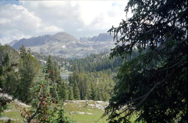
From Pass Above Gottfried Lake |
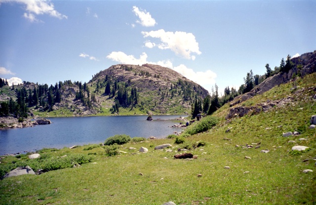
Heading out again, we made our way around the west side of the lake. The trail begins climbing again over a series of switchbacks to reach another pass (300' climb) above Borum lake. Charlie was hiking alone ahead of Kyle, Andrew and myself. I sent Kyle on up ahead to keep him company, but Kyle came back saying that Charlie would rather hike alone. Borum Lake is a pretty lake. There was a tent near the outlet stream but we didn't see any people. We took a short break at the south end of the lake having come about 2 miles from our start. The trail goes around the eastern side of the lake and climbs gradually over a small ridge northeast of the lake past some small ponds. When you get to the top of the ridge, the trail levels out and the first glimpses of Sky Pilot Peak and the Continental Divide Peaks to the east come into view. |
|
It's a little less than two miles from Borum Lake to the junction of the Pine Creek Trail and the Highline Trail at Summit Lake. To our right (east) we can see Pine Creek Canyon the major obstacle to east-west travel. Heading into a large basin, a couple of streams are crossed and the trail trends more easterly as we descend to Summit Lake. Along the way we note an unsigned trail heading off to the right to places unknown. |
|
Soon the "hackey sackers" were standing around in a circle batting the hackey sack around. I walked up the trail to get a view of Summit Lake. Above treeline, the lake lies at the top of the pass between the Green River Valley and Pine Creek. It looks like a pretty uninviting place to camp due to the lack of cover but to someone who has climbed all the way up the Highline out of the Green River Canyon, it probably looks pretty good. After lunch we head south on the Highline Trail as it first follows Pine Creek as it drains Summit Lake. In about 3/4 of a mile is the crossing of Pine Creek, which is easilly crossed on rocks conviently placed. Just before the crossing of Pine Creek an unsigned trail joins the Highline. |
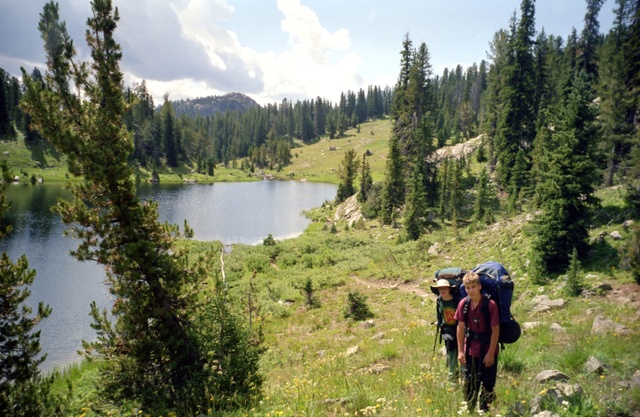
Austin, Bill P., Jon, & Roger |
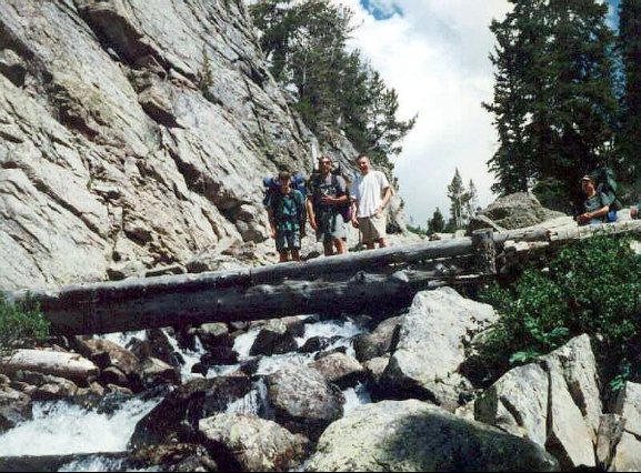
We speculate that it might be the unmarked trail that we saw previously and would be a shortcut between the Pine Creek and Highline trails. We can only speculate as we don't have enough time or inclination to explore it. After crossing Pine Creek the trail climbs slightly and in about a quarter of a mile from Pine creek another creek is crossed - on a bridge this time. This creek is Elbow Creek coming down from Elbow Lake. We take a short break in the comforting roar of the stream as it heads down to join Pine Creek. After crossing the creek the trail enters a series of switchbacks and climbs into a basin and snakes between a couple of small lakes. At the head of the basin, a few more switchbacks lead to a gentle pass over which Pass Lake and Gunsight Pass come into view. While we are taking a break a couple of hikers coming from Elbow Lake pass us by. |
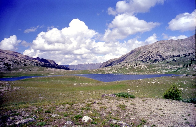
Making Our Way Around Pass Lake |
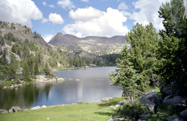
There is supposed to be a trail junction with the Bridger Lakes trail here but there is no visible tread - just an open meadow down to the lake. The route obviously threads between the lakeshore and a steep hill that seems to go right to the edge of the lake. Jason leads the group down to the lake where traces of trail tread become visible as it skirts the narrow gap between the hill and the lake. By the time I round the lake and make my way up to Gunsight Pass, the lead group has disappeared down the valley. Apparently the B.S.'rs did'nt look back to take in the view of Sky Pilot Peak and Pass lake through the notch of Gunsight Pass. Sometimes, I think that they tend to see more of the guy hiking in front of them than the scenery. |
Passing by Sauerkraut Lake |
When we made it to Gunsight Pass at 10500', we had reached the high point of the day but our climbing for the day was not yet over. We headed down the trail into a small basin below the pass and filled our water bottles in the stream flowing through it. At the edge of the basin the trail begins a descent through a narrow canyon. After dropping about 350 feet and nearly a mile from where we left the Highline Trail, we reach lower Sauerkraut Lake. When I finally got to the lake, some of the scouts had their rods and reels out and were trying their lures in the lake. I had them reel in and get going as the hour was getting late and we still had about 2.5 miles to go. |
|
Leaving Sauerkraut Lake the trail continues to head south through a narrow rocky draw that opens up as you reach a small pond to your right as you are heading south. This pond was completely dry when I was here in 1988. After you pass by the pond the trail turns east through a big meadow. Here the tread becomes indistinct and finally peters out. A few judiciously placed cairns leads across the meadow to the stream coming from the Sauerkraut Lakes. Across the stream, the trail can be seen heading up into the forested slope of the ridge paralleling the valley. Since we have about 500' to climb, we take a break alongside the stream before heading up. The trail begins switchbacking immediately. |
|
After gaining about 200 feet, the trail turns south on a steeply climbing traverse to the top of the ridge soon after crossing a torrent coming down from a couple of small lakes somewhere above. At the top a small pond is skirted and the trail drops to our destination, the 1st Bridger Lake (My nomenclature). We finally made it - about 9 miles from Trail Lake and about a 1900' climb. The camp area at the northwest end of the lake is small and we had to put some camps higher up on a bench. I had really been looking forward to fishing in this lake as it had been very productive in 1988 for 10 to 13 inch well fed golden trout. Looking out over the lake we didn't see any fish rising. After setting up the tents, rods and reels were taken out and everybody headed out to try their luck. Soon after almost everbody had headed out, the clouds rolled in and it began to rain. Those of us still in camp frantically rushed to get all the gear that had been left out under cover of the trees. Fortunately, soon after it started the rain ceased almost as quickly as it had come up. Unfortunately, the fishing was terrible - there just didn't appear to be any fish in the lake. Bill P. and Kyle fished all the way around the lake and never had a strike, had a fish follow the lure, or even saw a fish rising. It was much like Trail Lake the night before. We weren't getting much for our expensive fishing licences. I was really disappointed as this was one of the places I had really wanted to get back to. Even though the fishing was bad, the scenery was good and dinner was especially welcome because of the long trip that day. Unlike other nights along the trail, everybody turned in fairly early for our third night in the Bridger Wilderness. |