|
Troop 24 - The High Adventure TroopPyramid Mountain - August 1998
by Cascade Bill Mooseker |
|
|
Troop 24 - The High Adventure TroopPyramid Mountain - August 1998
by Cascade Bill Mooseker |
Pyramid Mountain is on of my favorite hikes. It is located on the ridge that is on the west side of Lake Chelan. The site of an old lookout, this is one of the few 8000+ ft mountain tops in Washington that can be reached by trail. Grand views in all directions are the reward for your effort.
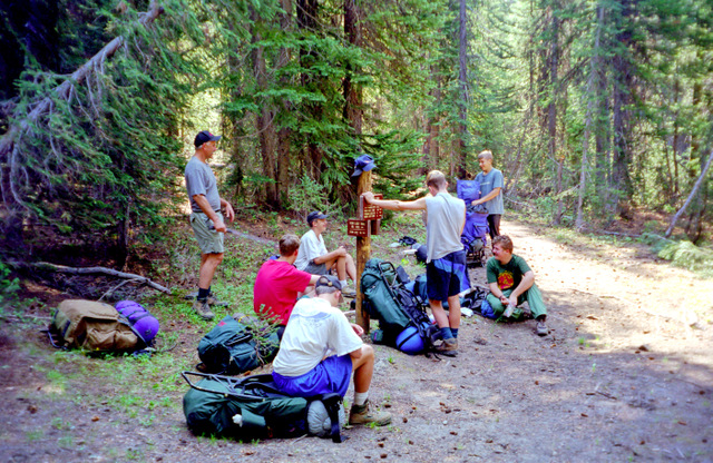
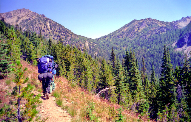
S. Fork Pyramid Creek Trail |
We didn't have a lot of time for a hike because of our Wyoming trip later in the month, so we were limited to a four night/five day trip. Our initial plan was to start at Big Hill and come out at the North Fork of the Entiat. Unfortunately, when we go to the turnoff to Shady Gap and Big Hill, there was a sheriff's car sitting there enforcing a road closure due to a forest fire. I figured out that we could do a loop trip from the N. Fork Entiat trailhead by using the little used Butte Creek trail. It would mean a lot more elevation gain for the trip to do it that way, but our options were limited. The first day was pretty uneventful with a valley pounder up the N. F. Entiat. We had hoped to get as far as the Fern Lake Trailhead but there was a large group with horses taking off at the same time that had were going to use the camp there as a base camp so we pulled up a little short to camp at Grouse Creek about a mile from the Fern Lake Trail. |
|
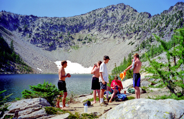
It didn't take us long to hike the short distance to the Fern Lake Trailhead. Our plan was to day hike to the lake, return and continue up the N.F. trail to Fox Camp. It is only about 1.6 miles to Fern Lake, but you have to climb 1700 feet in the bargin. In 1982, we did a fifty miler over part of this route, and hauled our packs up this extremely steep and primitive trail. I swore that I would never do that again. Fern Lake is a beautiful lake that sits in a bowl near the ridgetop. Just when you think that you are never going to get there, you pop over a mound of granite and, boom!, there it is. We had a good time fishing for the cutthroat trout that inhabit the lake. |
|
|
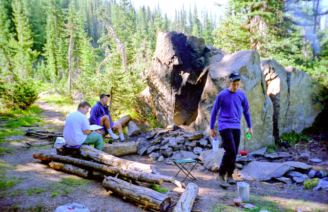
I was pooped when we got back down to the bottom. It was late afternoon, and we still had another 1500 feet to climb. By the time we all straggled into Fox camp we were all bushed. We had only hiked about 6 miles but we had climbed over 3400 feet, no wonder we were tired. Fox Camp is a good "fair weather" campsite. There are no sheltering trees, but a giant rock forms the backdrop for the firepit and makes for a cozy campfire long into the night. "Sundown Peck" (Bill Peckinpah) was in his tent and fast asleep before twilight. We were all tired and I don't think the rest of us stayed up too late. |
Near Fox Camp |
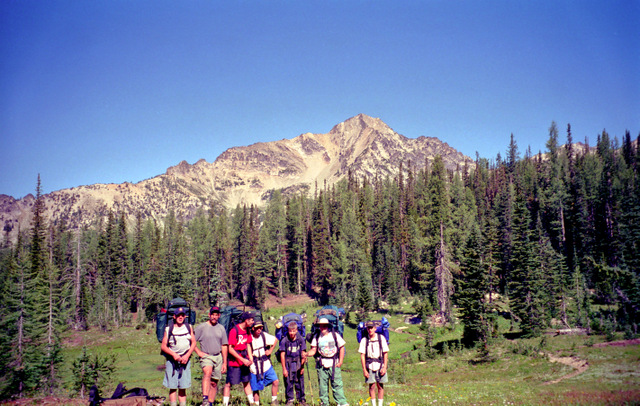
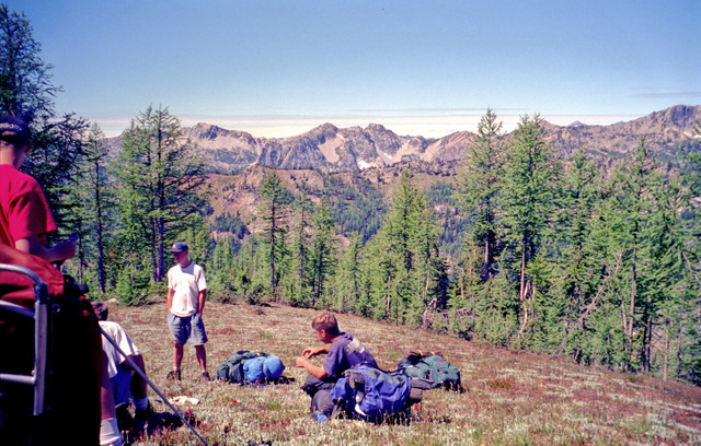
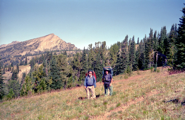
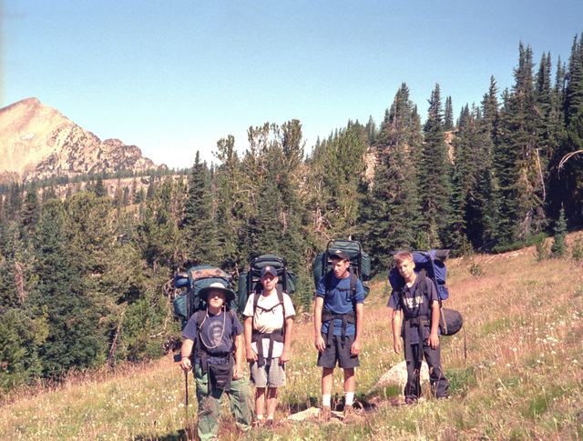
The picture at left shows the upper N.F. Entiat Valley from near Fox Camp. The mountain is Saska Peak and Saska Pass is located on the left side of the picture. This had been our usual route on a Pyramid Hike - Hike the Pyramid Mountain trail from Big Hill to Saska Pass and down to Snow Brushy Creek. On this trip we would backtrack about a quarter of a mile and head for Grouse Pass in the reverse direction. After the junction with the N.F. Entiat trail, the Pyramid Mountain trail makes a long ascending traverse of a ridge. Where the trail crosses the ridge, a viewpoint gives us a view of Pyramid as well as the smoke from the forest fire that had forced our change in departure points. The smoke was billowing out in dark omnious clouds. We couldn't see exactly where it was but it was a little close for comfort. |
and Grouse Pass |
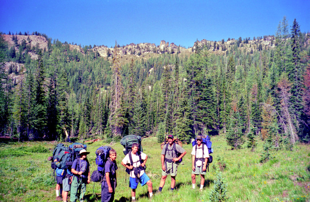
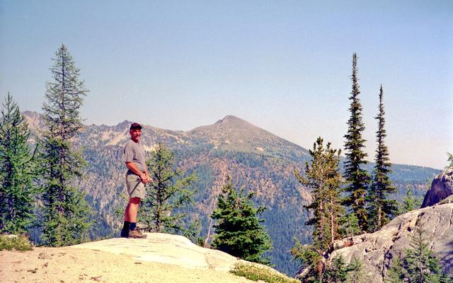
From the ridge, the trail drops 400 feet to Devil's Camp and begins to climb again, gradually at first then after a final crossing of Grouse Creek, it becomes very steep. We were all glad when we reached the top of grassy Grouse Pass. From the pass, we had a close up view of Pyramid just across the valley. From this vantage point, the mountain looks like the head and shoulders of a Gorilla. We had lunch, and the boys climbed to the top of a rock outcrop on the south side of the trail. Rested, we hoisted our packs and began the switchbacks dropping down the east side of the pass. It wasn't long till we arrived that that night's destination: Buck Camp. This is a very nice camp that is very popular with horse parties and has many convienciences, such as a table and a rock that is even bigger than the one at Fox Camp. Greg and I had stayed here in 1987, but there was another party here in 1995 when we had last passed through. |
A previous camper had left a couple of potatoes at the camp, so we quickly added these to the nightly menu. We had only hiked about 3.5 miles so we were in camp early and took full advantage of our leisure time to relax and soothe our aching muscles. After supper the boys played capture the flag in the meadow below the camp.
|
If you take the trail from Buck Camp, you lose quite a bit of elevation which must be made up again. In order to avoid this, I planned to go cross country and link up with an abandoned sheepdrive that would connect us with the Pyramid Mountain trail. In years past, I had followed this route, coming out near Grouse Pass. This time I didn't want to retrace our steps back up to the pass, so we headed NE out of Buck Camp following the stream from the upper meadows. The route is not difficult to follow, although the final ascent into the upper meadows is quite steep. When you get to the upper meadows you come around a shoulder that has a sandy pumice slope on the back side. If you climb up this slope baek to the shoulder, you will find the vague tread of the old Sheep drive. The tread is vague, so you have to look for it a few times but we had no trouble making our way up another basin. |
Old Sheep Drive |
As we climbed we scared up six or seven grouse. It was fun to watch where they landed and then throw rocks to get them going again. Just when we figured that was the last one, another would burst out of the bushes. At the head of the basin, the tread disappears in high grass, but you make for a steep sand gulley ahead of you. If you climb high, you find a steep path tromped into the sand. Kyle named this the "Sandbuster" which is in the photograph above. |
(Looking West) |
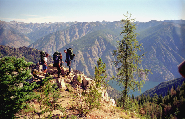
When you get to the top of the "Sandbuster", you go over a lip and find yourself on the west slope of Pyramid Mountain. We took a break, and then climbed a couple of humdred feet to the trail headed for the summit. Stashing our packs at the sides of the trail, we grabbed our water bottles and some snacks and set out for the top. The Lookout was destroyed many years ago per the official policy of the forest service, but the remains of the outhouse, and a rock cave used for storage still exist. |
|
From the top we could see the forest fire, comfortably a few miles to the south. We could make out a chopper dropping water on a hot spot. There was quite a bit less smoke today than there had been on the previous day. Views of Lake Chelan are spectacular. We could look to the east to the Chelan Summit where we had been the previous summer. And to the west we could see rows and rows of ridges making up the Cascades, with Glacier Peak most prominent among the many peaks. I pointed out Mt. Maude and Seven Fingered Jack, which we had camped near on a trip the previous August. The boys searched for bits of melted glass and rusty hardware left in the ashes of the old lookout. It was a good time to rest and appreciate the wonders of nature. |
|
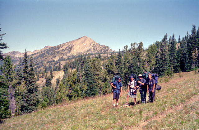
All good things come to an end and it wasn't long before we had to drag ourselves away and head back down the trail to get our packs and continue our hike out. Down, down, switchback after switchback the trail descends. It sure is a lot easier going down than it is coming up. After a bit the trail drops into a nice basin with possible camps, but we press on climbing about 200 feet out of the basin to meet the Pyramid Mtn trail just before it descends down to meet the South Fork of Pyramid Creek Trail. After another mile or so of ups and downs, we arrive at Meadow Camp, the usual first night camp if you are coming in from Big Hill. Everybody but me sleeps out under the stars. I know from experience that no matter how many stars are out when you go to bed, there is still a chance that a front will move in by morning. |
Near Graham Mountain |
We watched the shooting stars from the Perseid Meteor shower and saw again the owl that had mistaken the ball on Andrew's wool hat for a small animal in 1993. He flew over our heads a couple of times but didn't carry anybody off. We had a long way to go on our last day, so we headed out looking forward for our "porking out" experience at days end. In about about a quarter of a mile form Meadow Camp, the trail comes to an overlook down into Lake Chelan almost a mile below. Leaving the viewpoint, the trail climbes a couple of hundred feet up Graham Mountain and then begins a long scenic traverse. At our break, we discuss various burger joints we have been to and which was best.
|
|
|
Soon the trail heads down through meadows and past the viewpoint above from which we get a good view of Pyramid. A couple of hundred feet past the viewpoint, the trail goes around the end of the ridge and drops via a series of switchbacks into a small basin with a couple of rustic campsites near a bubbling brook.
|
After a break in the shade, we cross the creek and push on up a slight grade and then a long traverse of a wooded basin. After the tread levels out and then begins to climb, we come to a sharp switchback and soon to a shoulder of a ridge to the signed junction with the Butte Cr Trail. Initially the Butte Cr Trail traverses a shoulder of Crow Mountain. At first the tread is visible but it becomes intermittant and vague the further one goes from the junction with the Pyramid trail. Eventually all trace of the tread is lost in the grassy slopes. The map shows the trail going down the crest of the ridge so we make our way down until we pick up the tread again. At the end of the ridge, we follow the trail over the edge. It is obvious the the trail was once a sheep driveway because it is very wide and it drops very steeply. So steeply in fact that it is hard to go down and the strain on one's ankles and descent muscles is extreme. |
The advantage of a steep trail is that it gets to where its going very quickly, and it wasn't long until we came to the junction with the South Fork of Pyramid Cr. Trail. From here to the cars it was a long valley pound, seemingly neverending and very boring. Eric and Danny amuse themselves making up verses to "Henry the 8th, I am, I am!" until Bill Peckinpaugh banished them from the front. They were up to their 95th verse when I made them stay at least a hundred yards behind me.
At last we were out, and burger pangs became urgent. Our usual stop when we were near Entiat was Keene's cafe, home of the world famous Tiger Burger. Unfortunately, it had gone out of business since the last time we were here so we had to drive many miles until we decided to stop at "Rusty's Burgers" in Cashmere. Although not as good as a Tiger Burger, the Rusty Burger was a more than adequate substitute.